All Videos

WHY CHOOSE DRONEEPLANE?
-
Safe
A concern for safety is built into Dronee-PLANE’s design. Compared to similr UAVs,this drone is lighter in weight, safer to operate and its autopilot is preprogrammed in away that assures the safety of everyone in its operating area. DroneePLANE weighs only 780 grams, and is equipped with a secure pusher motor.
-
No Piloting
The DroneePLANE enables non-pilots to conduct challenging projects. The drone has a sophisticated design that enables even first time users to utilize the drone effectively. You launch the DroneePLANE simply by throwing it into the air, and then all you have to do is watch as the drone completes its mission and returns to its launch point.
-
More Coverage
The drone is able to cover an area up to 1,000 ha without having to recharge or land. DroneePLANE can take pictures of 1.5 cm(0.6in) of pixel density.
-
Everything you need to Fly
The DroneePLANE kit has everything needed to work with the drone. The kit contains one high-quality RGB camera, a set of batteries, a modem that works on radio frequencies, the DroneeCOCKPIT and state of the art software that will organize and manage the flight process.
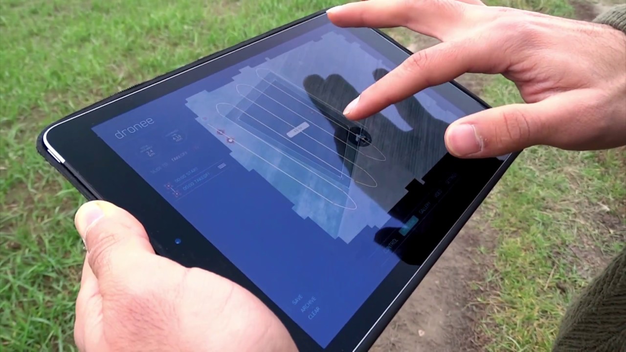
PLAN
With the DroneePLANE you are able to prearrange the flight and then supervise it in operation, using a robust Dronee Flight Control App that is fully compatible with your iPad.
All you have to do is pick the area you want to inspect. You then indicate the necessary ground resolution, which can be as low as 1.5 cm/ 0.6 in/ and pick the appropriate image overlap. That’s all you have to do. Everything else will be completed in the automatic mode. The DroneeCOCKPIT App will independently determine the most suitable flight pattern on the basis of GPS checkpoints, compute the necessary altitude and then present the route on the iPad screen.
The drone’s flight plan and landing zone can be changed in mid-issue should arise, you can order the drone to return home and land immediately. You’re always in control.
DroneeCOCKPIT supports Shapefile/KML/KMZ format of regions Multi Flight feature you can even scaneven larger area with multiple flights. If the battery finishes during the scan. Dronee lands and memorizes where it left in order to continue the next flight.
OPTIMISED FLIGHT PATH
For windy weather Dronee Flight Management Software has “Route Optimisation” algorithm, it rearranges waypoint orders to give less drift in windy conditions without changing the result of the process.
FLY
To start the flight all you need to shake the drone to start its motor, then throw it into the air-no catapult or additional
accessories required!
The Dronee App displays the aircraft’s flight parameters in real time on tablet display, allowing you to track your flight. The DroneePLANE autopilot continuously analyses onboard sensors to control and optimise every aspect of the flight. Battery level monitoring means the drone always makes it back to the landing area without running out of power; after a battery change, DroneePLANE will continue to survey from where it left off.

CAPTURE
SONY RX0 RGB Camera Multispectral Camera
With 1 inch sensor size It captures amazingly sharp DroneePLANE fully supports SEQUOIA
aerial RGB images, across a range of light conditions, camera for agriculture applications.
allowing you to produce highly detailed, orthomosaics
and highly precise digital surface models.
Technical features Technical features
Resolution: 21.0MP - 16 MP RGB camera
Sensor Size: 1.0-type (13.2mm x 8.8mm) - 4 SEPARATE BANDS
Exmor RS™ CMOS sensor *Green (550 BP 40)
Aspect ratio: 3:2 * Red (660 BP 40)
Image format: JPEG * Red Edge (735 BP 10)
* Near infrared (790 BP 40)

TECHNICAL SPECIFICATIONS
Weight: 0.5kg
Payload capacity: 0.18Kg
Wingspan: 90cm
Material: EPP foam and carbon structure
Detachable wings: YES
Propulsion: low-noise brushless electric motor
Carry case dimension: 40 x 43 x 30 cm
Camera: Sony RX0 RGB and Multispectral
SOFTWARE
Flight planning & control software: DroneeCockpit
Image processing software (optional): Agisoft, Pix4Dmapper, DroneDeploy
FLIGHT CHARACTERISTICS
Maximum flight time: 45 min
Optimal Cruise speed: 12m/s(45km/h)
Radio link range: Up to 5km
Maximum coverage in single flight: 10km2 (1000ha)
Wind resistance: up to 12m/s(45 km/h)
Landing accuracy: +- 5m
